Overview
A central interface for operations
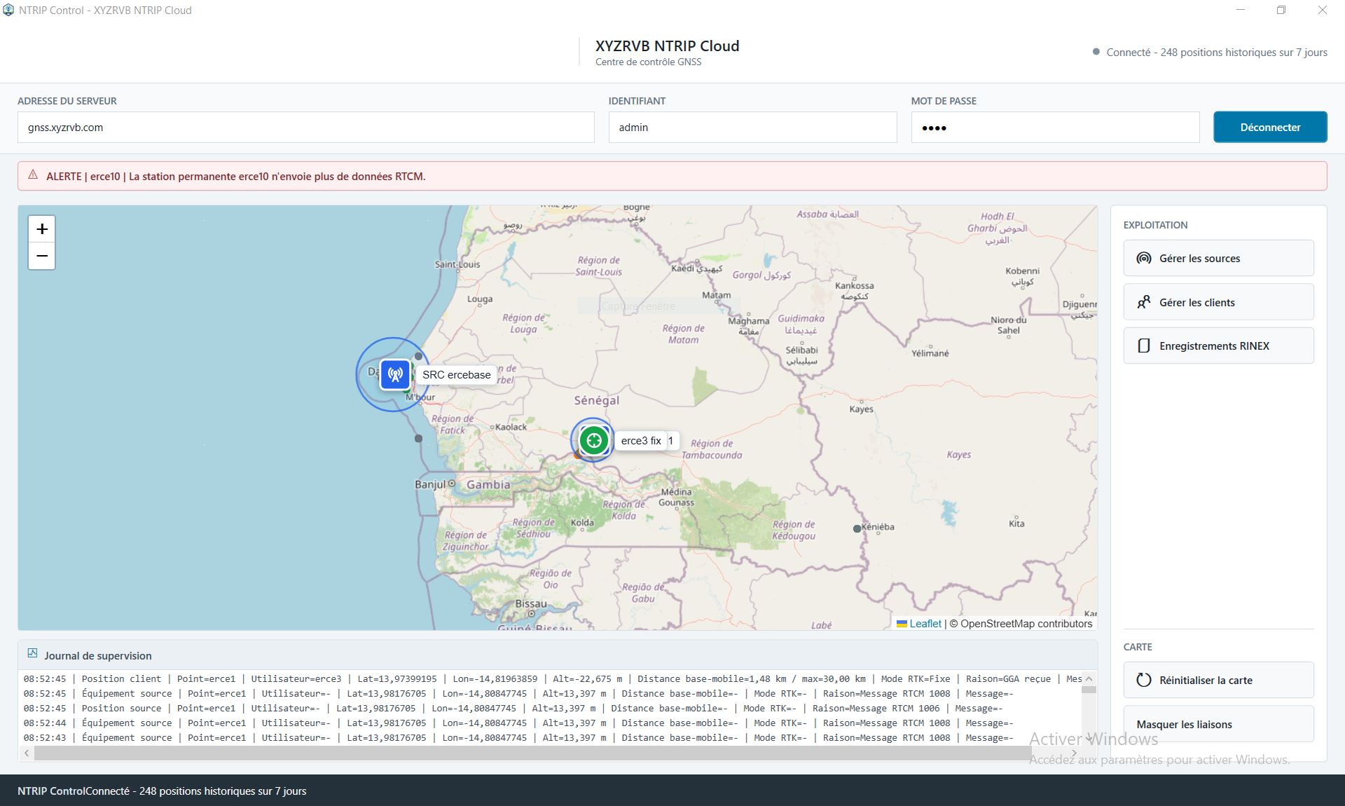
The main page gives an immediate view of the NTRIP Caster: connected sources, active clients, map positions, recent events and connection status.
Detailed operation
The NTRIP Caster and its control center bring together field information, NTRIP sources, rovers, position history, RINEX data and technical alerts.
Overview
The main page gives an immediate view of the NTRIP Caster: connected sources, active clients, map positions, recent events and connection status.
Base stations
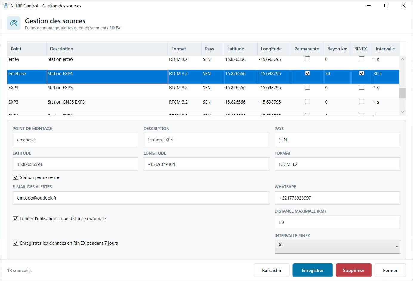
Base stations are declared with their mountpoint, description, coordinates, country, RTCM format and operating parameters.
A station can be marked as permanent, linked to email or WhatsApp alerts, limited by a maximum operating distance and configured for RINEX recording.
Rovers and mobiles
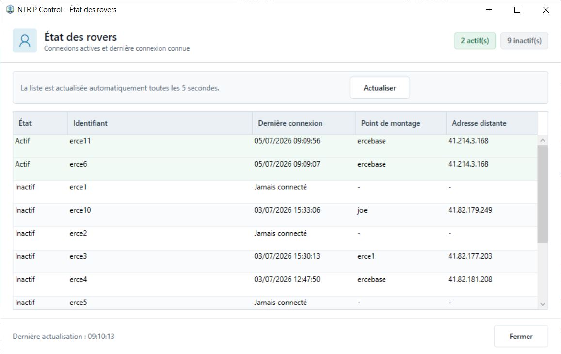
The rover list shows active, inactive, or never-connected devices. It displays the identifier, mountpoint in use, last known connection, and connection IP address.
This view helps supervisors quickly see which rovers are active in the field and which devices need attention.
Baselines
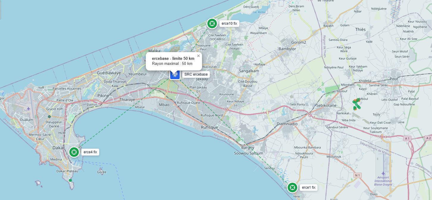
The map displays reference stations, rovers, links between each mobile and its base, and configured distance limits.
The supervisor can verify whether a rover is using a station suitable for its position and identify baselines that are too long.
Post-processing
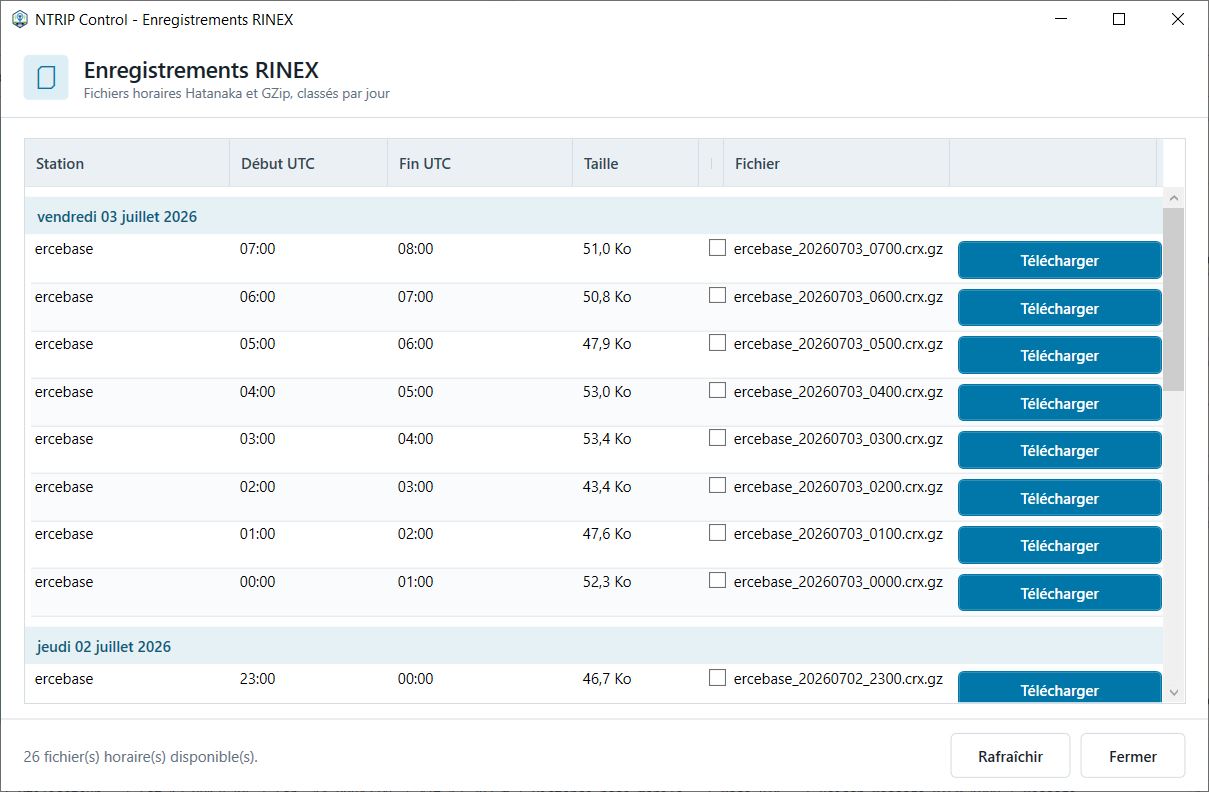
Station RTCM streams can be converted into hourly RINEX files, compressed with Hatanaka and GZip, then organized by station and day.
These files can be downloaded for post-processing, quality control, observation review, and geodetic studies.
Multi-caster relay
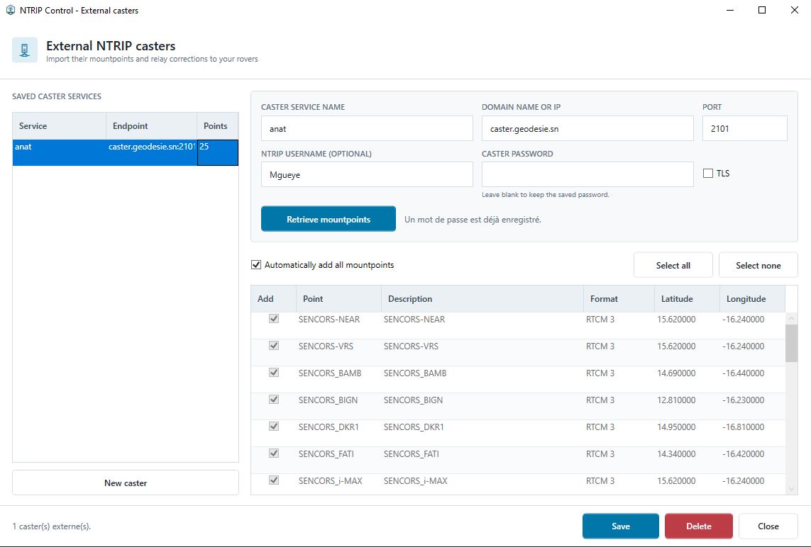
An administrator can register another NTRIP caster’s domain, port, TLS mode, and credentials, then retrieve its sourcetable.
Selected mountpoints join the company source list. XYZRVB opens the external stream on demand and relays its binary RTCM data to authorized rovers without text conversion.